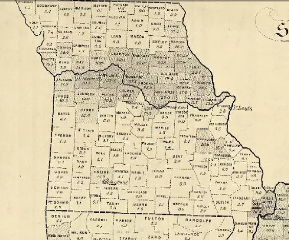
Below is a map from the 1860 U.S. Census showing slave population in Missouri. Surprisingly, perhaps, the biggest concentration of slaves wasn’t in the southern part of the state but, instead, along the Missouri River corridor. Two notable exceptions being New Madrid and Mississippi counties bordering Kentucky.
President Abraham Lincoln used a larger map of the South — viewable here — in determining which states might secede from the Union. Missouri had 114,900 slaves in 1860, accounting for 9.7 percent of the state’s total population. States such as Mississippi and South Carolina had more than half their population enslaved.
H/T Plog.